Contour Lines explained
Contours can be thought of as like a stack of irregular pancakes, with each contour line representing the edge of the pancake. If the contour interval is 1 metre, each ‘pancake’ would be 1 meter thick. A 100 metre contour represents a line on the ground that is 100 metres above a vertical datum such as mean sea level.
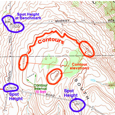 Contours, source: http://www.acsu.buffalo.edu/~dbertuca/maps/cat/map-portion-images.html
Contour Interval
Contour Interval is the vertical distance between consecutive contour lines, a 10 meter contour interval means that there is a 10 meter difference in height between one contour line and the next. On a topographic map the contour interval is usually stated somewhere in the map legend, or under the map scale bar.
Index and Intermediate Contours
Index contours are thicker and are usually every fifth contour line, if the contour interval is say 20 metres the index contour would be on every 100 metres above…
View original post 90 more words